
Here is the route
What you will see
At a glance
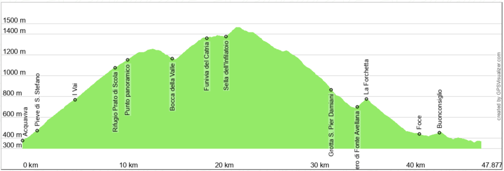
Up and down
Description
The departure is from Acquaviva, a hamlet of Cagli along the road to Frontone. Just before a bar, take the provincial road of Tenetra, known locally as Catria road. After a short straight stretch, at the second bend, the road runs alongside the Parish Church of S. Stefano, now in ruins, but which in the past was an important place of worship.
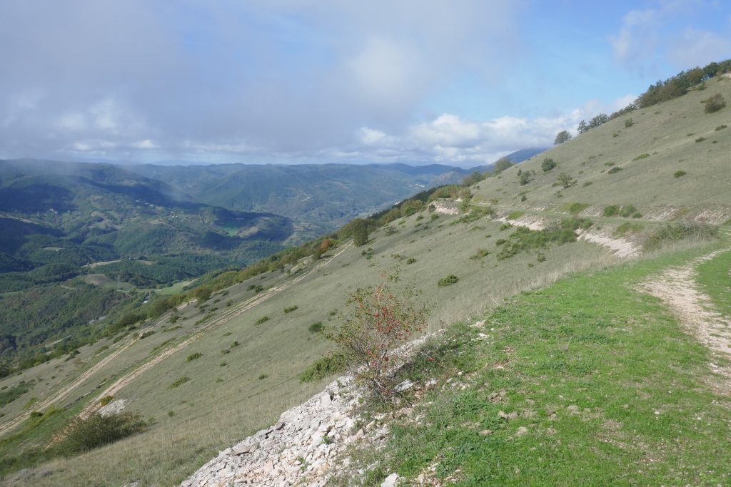
The climb becomes more difficult and runs along the slopes of Monte Campifobio and Monte Bambino, having on the left the Mount MezzanoIt reaches the I Vai pass, which overlooks the Burano gorge, and continues uphill to climb towards Monte Tenetra, alternating between forested areas and meadows. Along the way, it's easy to encounter grazing cattle or horses. I met one, right next to the road, which did not disdain the berries of the thorny dog rose.
As you climb in altitude and pass the Prato di Scola refuge, the view becomes increasingly wider towards the Mount Petrano and Mount NeroneAfter a sharp bend, the road passes beneath the peaks of Monte Tenetra and Monte Alto. From here, a moderate descent begins, which in the final stretch opens up towards CantianoThe descent ends shortly after the Bocca della Valle saddle, from where you can admire the south-west face of the Mount Sharp. After passing the small refuge Mochi House the road crosses the one that goes down towards Buonconsiglio, now impassable due to the damage caused by the flood of September 2022.
Continue uphill to go around the western and northern slopes of Monte Acuto crossing a thick beech forest. Go under the cables of the Catria cable car, near the Cupa delle Cotaline refuge, where, in addition to the cable car arrival station, there is a bar and a restaurant. Continue, alternating gentle climbs and descents, until you reach the Infilatolo saddle, where you intersect with the road leading down to Chiaserna, also impassable due to flood damage. Continue uphill to reach the highest point of the trail, just below the Vernosa refuge. Now relax; the trail continues downhill, with magnificent views and notable points of interest.
The first section follows a pleasant forest road that crosses the western slope of Mount Catria. At the third bend, you'll cross the road leading to Fonte dell'Insollio and Pian dell'Ortica, but you continue downhill. Where the view opens up, you can admire, to your right, the steep walls of Balza dell'Aquila and, below, the gorge where the Cesano River flows.
You reach a stretch of road, known as The Ladders because a dense series of hairpin bends allows you to go around the steep walls of the Porrara CliffThis stretch is beautiful; take your time. In May and June, you can admire the blooms of the laburnum, which here mixes abundantly with the beech, while elsewhere it is rare or absent. In some places, where the forest thins out, the view opens up towards the Mount Cilio and the Witch's Mountain. Next to one of the last hairpin bends you will find the signs for the Grotto of St. Peter Damian, which you can reach on foot in a couple of minutes.
Continuing down, just before the intersection with the provincial road, the route offers the most beautiful view of the Fonte Avellana Monastery, whose foundation dates back to 980, perhaps by Saint Romuald. Saint Pier Damiani became a monk there and, in 1043, prior, inspiring the hermitage to undergo intense development and making Fonte Avellana a cultural and religious landmark.
Once you reach the provincial road, take it on the left uphill to reach the pass The Fork, starting point for many excursions on foot or by bike. Now, a long and fast descent (pedal with caution) leads to the icrossroads with the Caprile roadContinue to the right, passing a quarry and then a locality Mouth until you reach Frontone. From here, turn left onto the provincial road that will lead to starting point, near Acquaviva.
c
Notable places
Download and Print
In “Other Settings” adjust the “scale” to have the route map on a single page. The value 80 should work