Here is the route
What you will see
At a glance
Up and down
Description
Once you reach Buonconsiglio di Frontone, you leave the car at the beginning of the road that goes up towards Monte Catria (which ends after a few kilometres).
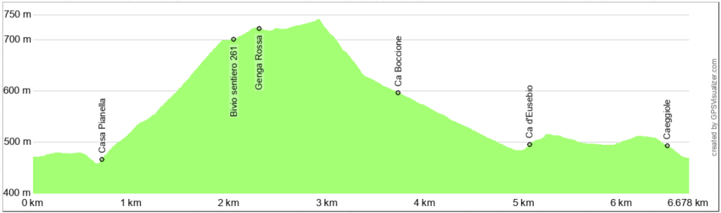
Walk along the road past the few houses of Catozzo, then turn left, descending towards the Mandrale River, which you cross via a convenient little bridge right in front of the large, ivy-covered Casa Pianella. From here, a rather steep climb begins, cutting across the western slope of Monte Spicchio. The climb follows trail 261 and follows a wide dirt track through a coniferous reforestation. The reforestation was carried out decades ago, and you can see the thinning done to encourage replacement with native broadleaf trees. As you ascend, the view opens to the west, towards Monte Petrano and Monte Campifobio, which overlook the city of Cagli.
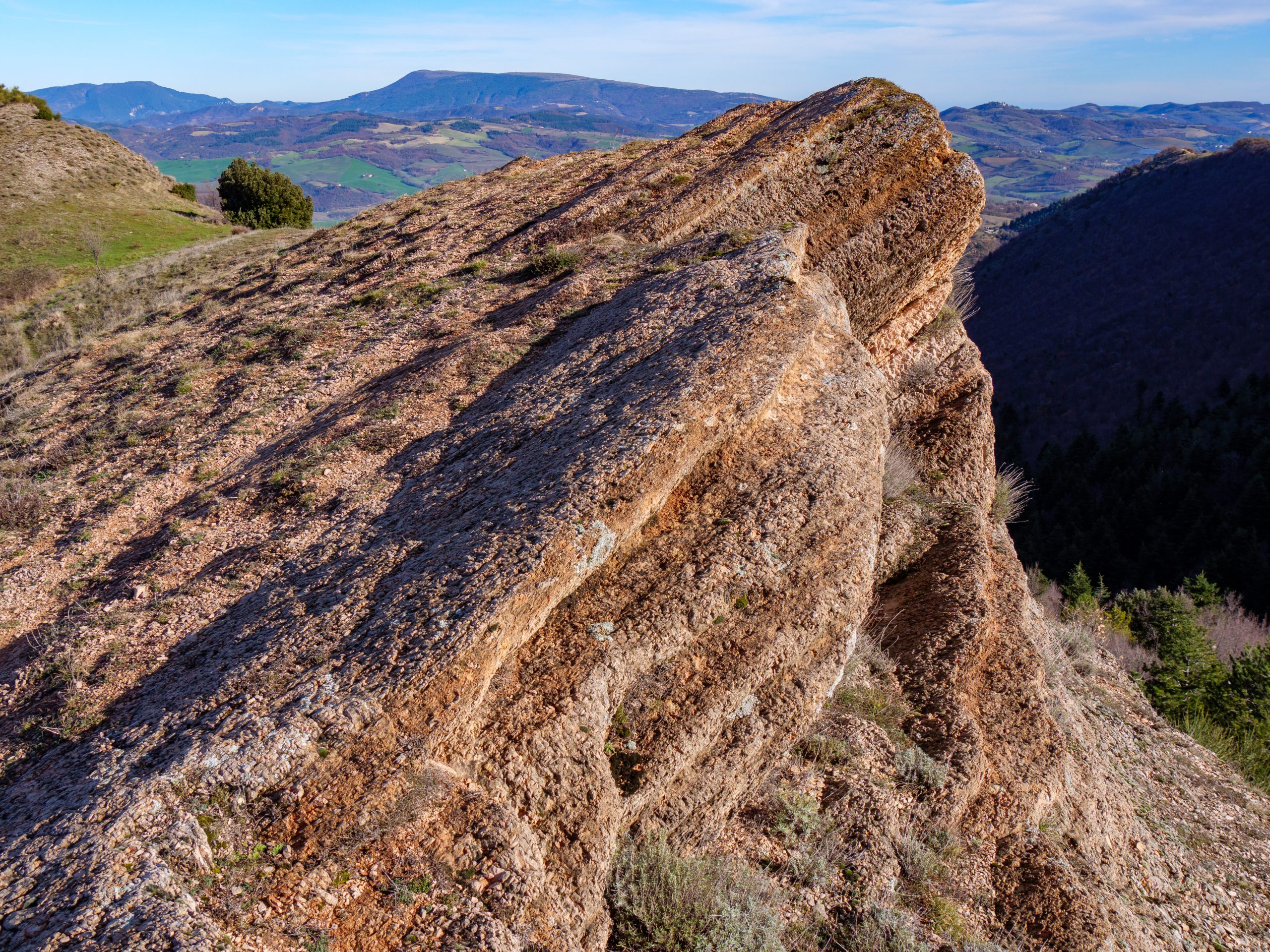
Shortly after a left bend, you reach a fork in the road. Turn right, continuing uphill on trail 261. At the first left bend, there's a panoramic viewpoint. A few meters further along, you'll reach a pyramid-shaped spur pointing east, known as Genga Rossa for its vibrant colors, especially at sunset.
Retrace your steps and continue along the easy, wide trail 261. The summit of Monte Catria can be seen in front of you. When you reach a fence, turn sharply right onto a steep, downhill forest road. The trail is loose and can be muddy and a bit slippery after heavy rains.
After a short while, the forest road joins the dirt road that climbs towards the hermitage and refuge of the Madonna dell'Acquanera, a site of pilgrimages every September 8th. Continue downhill until you cross the Mandrale River at the small village of Ca' d'Eusepio.
Follow the only narrow road through the village, passing houses and then vegetable gardens, until you reach a dirt road coming from Paravento, part of the Cammino dei Cappuccini. From here, turn right and continue until you reach the few houses of Caeggiole, from where you can return to the starting point.
Notable places
Download and Print
In “Other Settings” adjust the “scale” to have the route map on a single page. The value 80 should work