Here is the route
Click on the Marker to open Google Map
What you will see
At a glance
Up and down
Description
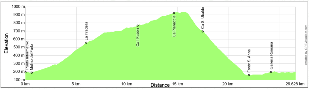
the starting point is the parking lot in the small village of Furlo. You can also start from Acqualagna with a few kilometers of transfer. From the parking lot, pedal towards Acqualagna for about 250 m, then go down to the left to cross the Candigliano River with a bridge. From here begins the comfortable climb of the asphalt road that leads to Tarugo, passing through the Fosso del Rio valley.
After about 3 km turn left onto a dirt road, where the climb becomes a little more tiring, but still easy to ride. Pass under the small town of Borgo and continue with the Fosso del Rio valley on your left, from which you climbed. You are now riding along the MTB route n. 2 of the Riserva Naturale della Gola del Furlo. After a few hairpin bends you arrive at the “La Pradella” refuge. Now the climb is gentle and pedaling becomes a real pleasure due to the beauty of the route and the views that open up towards Monte Pietralata.
The path bends east and enters the Valle dell'Inferno, arriving at the foot of Case S. Ubaldo. Now turn right, taking itinerary 3 to climb the eastern slope of Monte Paganuccio, until you reach Ca I Fabbri, a recently renovated building where meetings and educational activities organized by the body that manages the Reserve take place.
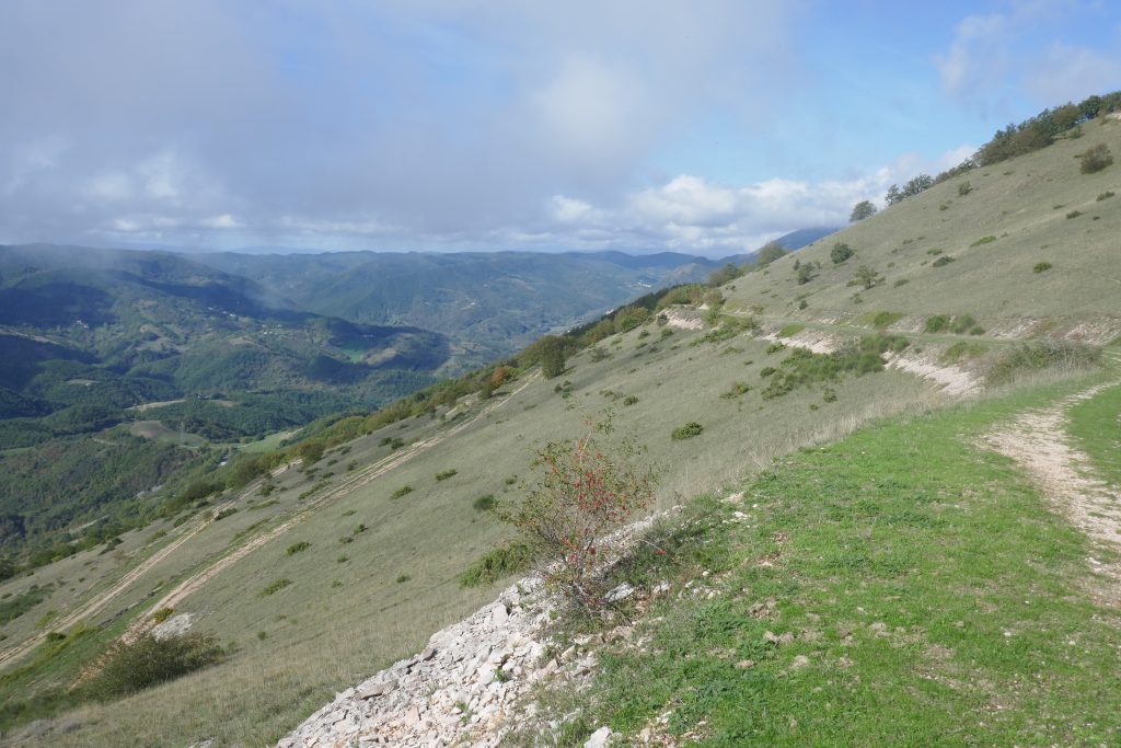
Continue, without deviating, along the wooded north-east side of Paganuccio, until you reach the summit meadows, which you will go around with a large clockwise loop. As you advance, the view opens first to the north, with the Cesane mountains and the Metauro valley up to the sea, then to the east, in the direction of the hills overlooking the Cesano valley, finally, to the south with the ridge outlined by the Catria, Acuto, Tenetra, Petrano and Nerone mountains. In this section the route is mainly slightly uphill.
Once you have passed Le Pianacce and arrived at Il Sodo (names that define vast meadows indicated by signs), the descent begins that will take you to close the ring of the summit of Monte Paganuccio, returning to the road you have already taken.
Once you reach Case S. Ubaldo, turn right to take a long descent, with a well-maintained surface, but to be traveled with caution due to the presence of loosely compacted gravel. The descent will take you to the Via Flaminia, passing by the bottled water factory of S. Anna. Turn left to enter the Furlo Gorge. On days preceded by heavy rains, I recommend stopping near the dam to observe the impressive waterfall.
Then pass the Roman tunnel of the Furlo Pass dug into the massive limestone of Monte Pietralata, and, calmly riding along the last stretch of the gorge, return to the starting point.
Notable places
Download and Print
In “Other Settings” adjust the “scale” to have the route map on a single page. The value 80 should work